The Harrowing Experience of The Poor Living along the Malindi Salt Belt
Source: Ujamaa Center
Over the past ten years, the Ujamaa Centre has worked with people and communities in the Coastal region to enhance popular participation in socio- economic and social justice processes; community based decision- making and governance and efficient and sustainable use of natural resources. The Center’s work has revealed that it is possible to transform the status of so many people/ communities if they are actively engaged in the development processes within their areas, influenced, capacitated and empowered on the utilization of locally available natural resources and equipped with advocacy skills to address social injustices / fight for their fundamental rights among others. Currently, Ujamaa Center is implementing Mobilizing People- based Organizations for Equitable Access to Land and Other Natural Resources Project. The project aims to empower the poor communities of Kilifi and Malindi districts to own, access and control their land and other resources for sustainable local development. Malindi District is one among the seven districts of the Coast Province. The district was carved out of Kilifi District in 1996 in a bid to bring administrative services closer to the people. It borders Kilifi District to the South, Tana River district to the North and Northwest and the Indian Ocean to the East. It is located about 120 kms northeast of Mombasa and is one of the large tourist towns along the coast. In 1498, the town was a kingdom and wealthy. The economy consisted of agriculture and trade with various ports in the Indian Ocean. There were large plantations with fruits (i.e. lemons, oranges and mangoes among others), coconut palm trees, vegetables and cattle around it. The town mainly depends on Tourism and salt manufacturing industries. However, it has great potential for farming and fishing which are yet to be fully exploited.In Malindi, there exist 6 salt manufacturing companies/ firms which also play pivotal role in the area’s economy. They include Kensalt, Mombasa Salt, Krystaline, Kemu Salt, Malindi Salt and Kurawa salt manufacturing companies.
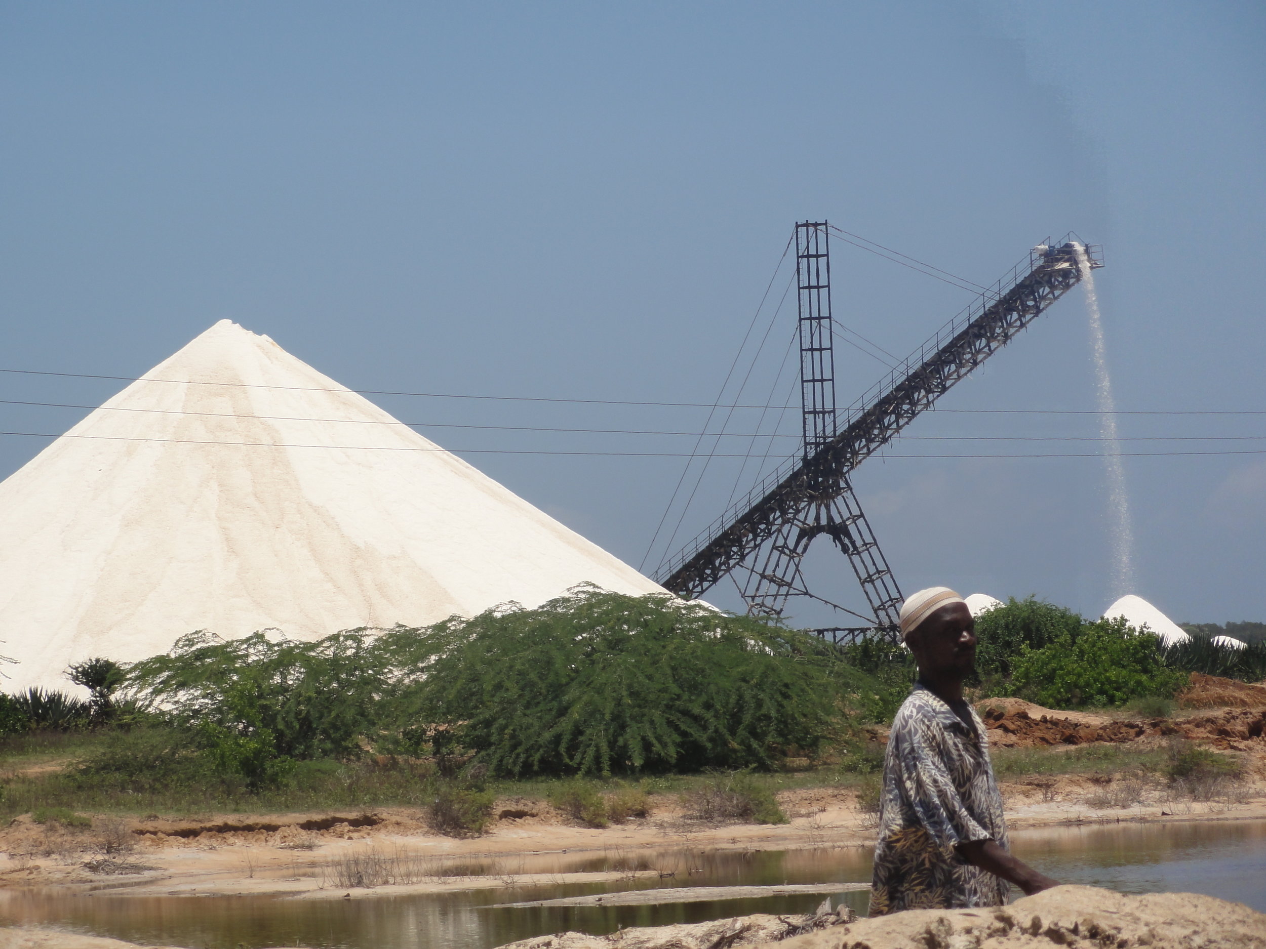
One of the Salt Companies
Beneath the veneer of the successful mining firms are tales of hopelessness as many local residents are living under the fear of eviction, environmental induced illnesses, human rights violations and general exploitation. This is evident as moving toward Marereni on the Malindi- Garissa road, from a distance you can see heaps of silvery unrefined salt dominate the extensive and well tended pans. The population lives in absolute poverty i.e. they are unable to meet their basic needs to scale i.e. food, shelter and clothing. Despite the government adjudicating several schemes within the area, still majority of the residents is landless and are identified as squatters as they have no legal documents for land ownership (own land customarily).
Land is a critical factor of production and is therefore at the center of contemporary discourse on human rights in Africa. It is the key to containing poverty and maintenance of sustainable livelihood systems in the third word. Access to land is regarded as a fundamental human right. Land is one of the major issues in Kanagoni and Coast region at large one of the reasons being the post-colonial administration perpetuated injustices against the community by leasing land to salt manufacturers among others. Even as they did this, the community was left without recourse to alternative and equally arable land. The legal basis allowed the state not to compensate the people for land leased to farms was an unjust law because the community had the de facto ownership and use of the land for many generations. The landlessness of the indigenous communities in Marereni and Coast region at large is mainly to blame for the rampant poverty therein. Currently, bad situation in Malindi salt belts is further worsened when after independence hectares and hectares of land were leased out to investors with no boundaries established with ridiculous grants (ninety nine year) at equally ridiculous rates for instance Kurawa Salt Company pays Ksh. 15,000 yearly to the government.
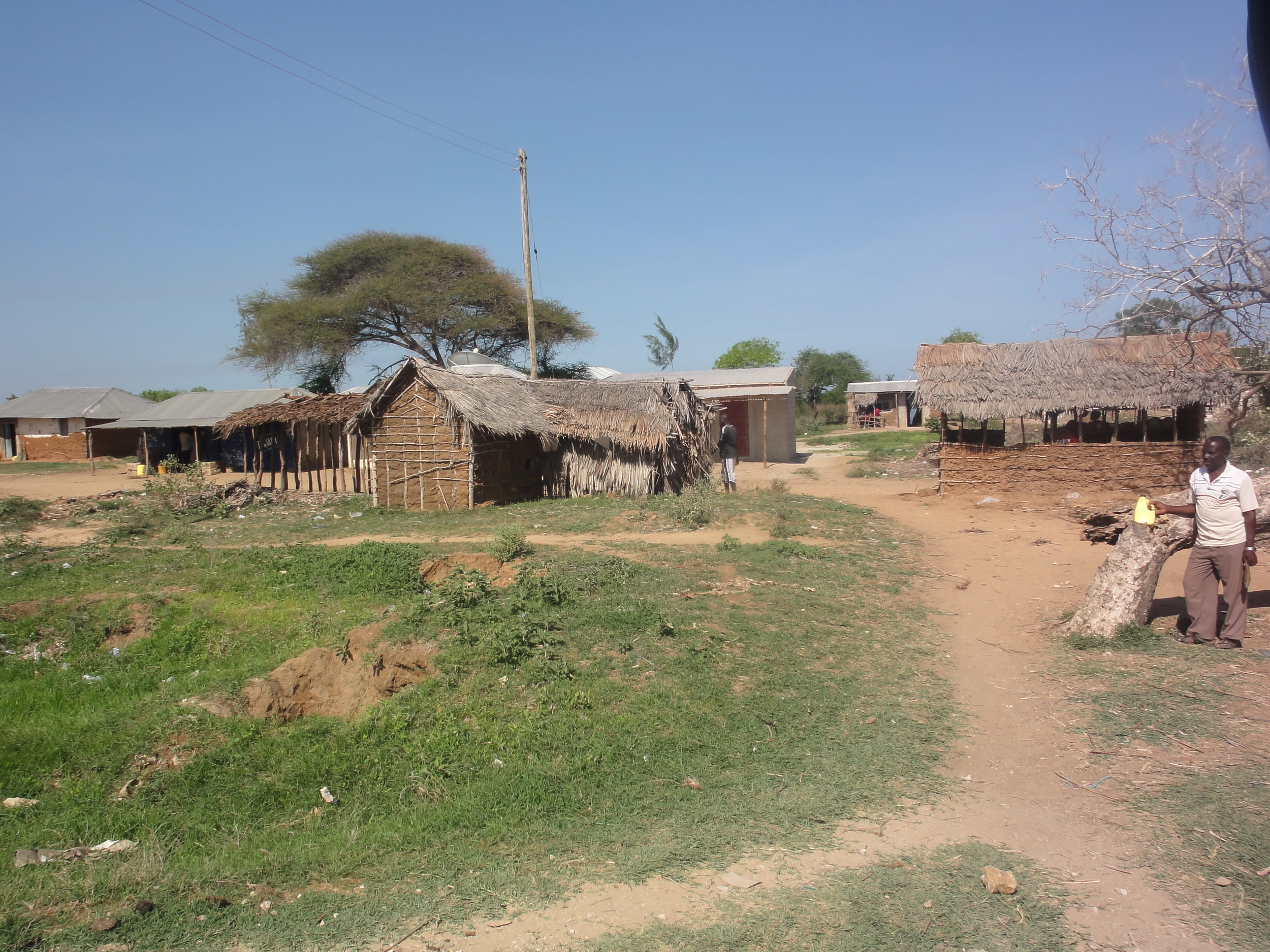
Marereni
According to the constitution land lease has been reduced to 99 years. Therefore Kurawa Salt Company has remained with 19 years and is seeking to reapply for renewal from the land commissioner. The local residents felt that since 1975 to date Kurawa has not given enough back to Kanagoni community. Kanagoni community has been left with a small piece of land which the local residents scrape out a living under constant fear of being evicted by Kurawa and other salt companies within the area that is intending to extend their land leasehold to extract more salt. Beatrice Njoga (a local resident) said, “Evictions has made most of the people suffer as they spend sleepless nights in the cold.” Some local residents expressed their frustrations as they felt that they are oppressed due to human rights violation. They said that for a long period, the lords of the salt mines e.g. Kurawa have been riding roughshod over area residents with impunity. They went further to share on current situations, the residents’ situation is worse than when the salt companies began operations. Areas that were previously covered by mangrove, cashew nut, mango trees and coconut palms have now been reduced to bare ground as more land is cleared to mine salt resulting to forced evictions. The local residents have often denied claims that Kurawa Company constructed a bridge yet it has blocked some of the footpaths used by residents of Kanagoni to access their field as the dykes are holding water from flowing into the sea causing road disaster as there is no access route to the beach for residents. The salt mines have also affected wells as they have become saline forcing residents to either walk longer distances in search of water or to buy it at very high cost from vendors. This is the deterioration of the environment through depletion and pollution of natural resources such as air, water and soil; the destruction of ecosystems and the extinction of wildlife. It is the reduction of the capacity of the environment to meet social and ecological objectives and needs. This is practiced in Malindi at the salt belts as natural habitats are destroyed or natural resources are depleted, environment is degraded as it has become less valuable. In Marereni, this occurs through human processes led by salt mining firms within the area. The largest areas of concern at present are the air pollution, the destruction of the marine, and ruined local environment among others. This has destroyed many natural habitats and the plants and animals native to the areas. Nickson Kahindi (a local resident and a fisherman) said, “Salt companies pollute the environment. Ministry of Fisheries and environmental officials have visited the sites and know the challenges but did not take any action.” Ujamaa Center in partnership with Malindi Rights Forum, Akiba Mashinani Trust and Muuungano wa Wanavijji and Muungano Support Trust conducted mapping and enumeration exercise in Marereni to assist in identifying the pressing issues to assist in advocacy in Marereni -Malindi. Community mapping have been used by grassroots organizations and community-based organizations to enhance their activities. It helps organizations provide better services, create and improve linkages with government agencies and NGOs and advocate on behalf of community. Community mappings often lead to mobilizing community members and other stakeholders to address community needs. Communities do think about conducting a community mapping when it needs to know more about the conditions and the needs of a community. Mapping generally focuses on particular issues. More information helps make existing activities more effective, and is the basis for developing new activities. • Mapping helps to create community eviction watchdog groups, • Implement women’s income-earning programs • Plan a new town center • Advance campaigns to stop evictions and harassment Mapping and Enumeration Process A community mapping strategically involved many community members to find out more about the issue. First, there is a preparation process, in which member of an organization decide what they want to find out and how they will obtain that information. Then the organization goes through the community to complete the mapping activities.
Simiyu(MuST) and Joan( Ujamaa) doing GIS mapping in Malindi Salt Belt Before the beginning of the mapping exercise, the community was prepared to make strategic plan to manage the community mapping activities by deciding on what we wanted to achieve (issues and objectives), deciding what questions we wanted to answer, which stakeholders to involve, decide which methods we would use of each participants and make connections with the people who will be involved in the process.
The team then undertook: Enumeration: a team from Ujamaa Center, Akiba Mashinani Trust and Muungano wa Wanavijiji, Muungano Support Trust and Malindi Rights Forum (Community members, young men, landlords, religious leaders,elders,chief,health care officials ) went through the community ,recording the responses of community members with a questionnaire covering a stretch of 53 km. Map- drawing: A group of community members drew a physical map of the community to represent the spatial aspect of the issue and use of GIS from Gogoni village to Garite Village. Interviews: Interviewers asked individual community members to speak in depth the history of the place and socio economic activities. The interviews revealed more details about how and why problems exist in the community based on their experiences of different people in the community. Some of the sample survey questions included personal information, Income, land. House/living space, evictions, facilities e.g .water, latrine, community facilities, community organizations etc Focus Group Discussions: A group of community members who understand the situation spoke in details about the issues, the role that they see themselves and others playing in relation to the issue.
The data was then collected in Garithe, Kadzuyuni,Kambi Ya Waya, Kanangoni,Marereni town,Msumarini and Parts of Gogoni village and took almost one month, even though it was not completed due to expansive area than anticipated, lack of resources , lack of good political good will from local Provincial administration that hampered with the process for almost three days. The findings of the research has already been documented and is expected to be shared with the in April 2012, the documentation has been simplified with more visual and participatory methods. These will help Malindi Rights Forum in a new area in their advocacy work, thus generate data to support advocacy work in Marereni-Malindi area. Through the talks spearheaded by Ujamaa Center between Marereni communities, salt companies, district land surveyor and Planner, there are talks to replan Marereni town.


